|
|
|
|
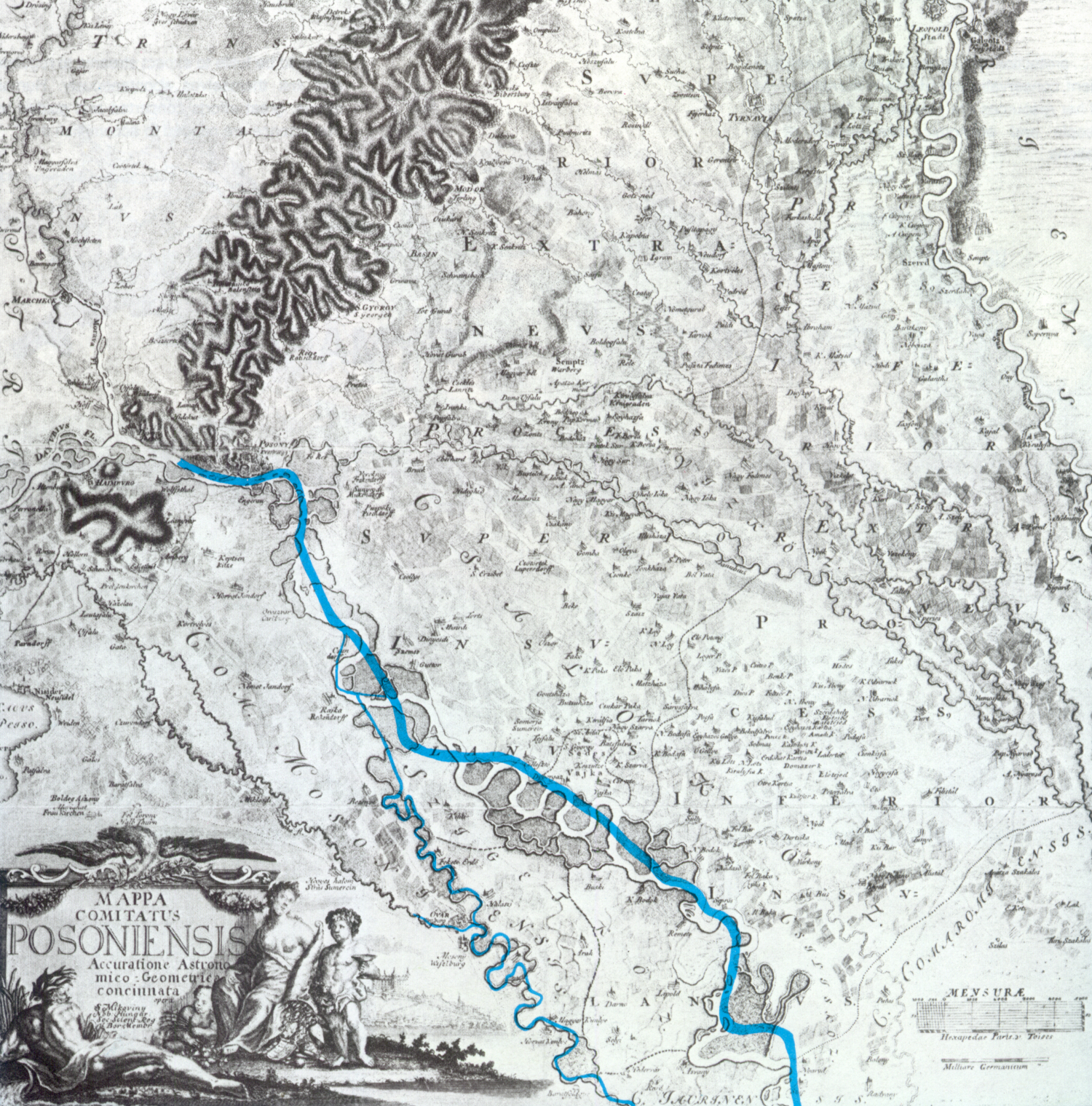
The former and present beds of the Danube on the map of Samuel Mikoviny from 1700 |
|
… protection and improvement of the environment, conservation of nature and the rational use of her resources are essential to the welfare of people and economic development of all nations …” [Helsinki, August 1, 1975] |
“It would be futile to expect streams to regulate and link themselves spontaneously. Human efforts, great efforts concerted and guided by true science are needed to accomplish this.” [Count Stephen Széchenyi, 1830]
|
GABČÍKOVO – NAGYMAROSENVIRONMENT AND RIVER DAMS
|
The Danube is the common natural asset of Europe. The gross national product generated in the 817 thousand square kilometers large river basin makes her in terms of economic output the most important river in the world, although with a length of 2,860 kilometers she is only the twenty-eighth on the list.
Over 70 million inhabitants of eight riparian countries, or twelve per cent of the continent's population are directly influenced in the basin. The vast flow carried in the river is an essential element, a vital factor of biological life, human, plant and animal alike, an irreplaceable raw material, transport carrier to a continuously developing economy, while at the same time she is the recipient of the effluents, the waste waters of a wide variety of human activities.
Following the inauguration of the Danube-Main-Rhine Canal, the Danube will become the Eastern backbone of the 3,500 kilometers long transcontinental waterway linking the Black and North Seas. The people of Europe display therefore, understandably a keen interest in the fate and future of the Danube.
|
|
|
|
The former and present beds of the Danube on the map of Samuel Mikoviny from 1700 |
|
|
|
|
|
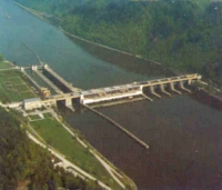
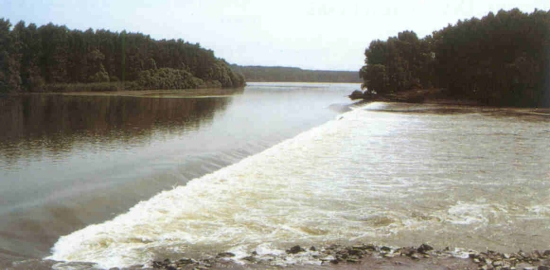
The river dam Aschach |
The backwater reach above Aschach |
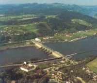
The river dam Ybbs-Persenbeug |
|
|
|
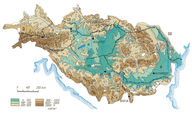
Topography and hydrography of the Danube Basin |
The importance of the Danube, the necessity of her regulation and development was already recognized in ancient times. The Romans excavated a canal to bypass the dangerous rapids in the Iron Gate section on the Lower Danube. Emperor Tiberius ordered the building of regulated banks and a towpath to facilitate the upstream passage of barges. A memorial in the Kazan Gorge perpetuates the glory of the Emperor Traian under whom the project was completed.
Emperor August had a coin minted around the beginning of our era bearing the inscript "Salus rei publicae - Danubius", or "Danube - the welfare of the Empire".
The first to attempt the construction of a canal linking the Danube with the Rhine was Charlemagne. So that he could deploy his armies against the barbarians easier, he ordered, in 792, construction to begin on the Fossa Carolina to connect the two river systems. The level of technology was, however, too low at the time to permit the project to be completed.
Queen Mary, wife of Béla IV, who ruled from 1235 to 1270 had, according to some documents, a new straight bed excavated for the Danube between Bratislava (Pozsony) and Gönyű to protect her Moson estates from the floods on the river.
The people of Hungary have often been harassed by the errant rivers over the centuries. The lowlands in the Hungarian Plains were permanently inundated, or flooded each year as late as the middle of the past century.
Conditions conducive to the development of modern industries, transport and urbanization, and to raising the level of agricultural production were created by the ambitious project of river regulation, flood control and land drainage completed largely in the second half of the past century to the plans of Paul Vásárhelyi.
The organizing skills of Count Stephen Széchenyi (1791-1860), a prominent politician of the Hungarian reform era, the builder of the Budapest Chain Bridge named after him, and the founder of the Hungarian Academy of Sciences, were the driving force behind this vast reclamation project, referred to as the second conquest of the country. He was also the most ardent advocate and, subsequently as government commissioner, the manager, of the efforts at improving the conditions of navigation over the Lower Danube.
Today we appreciate the beauty of the Hungarian river landscapes as they were created and shaped by our predecessors. Most of the landscapes inspiring leisure, recreation and aesthetic pleasure, invoking the illusion of Nature undisturbed over the centuries have been shaped by deliberate and consistent human interference.
At the time of their conception these plans were subject to violent criticism. Paul Vásárhelyi, whose name is still being mentioned among the most outstanding representatives of the profession in Europe, tell victim to one of the debates questioning the soundness of his ideas. On leaving the meeting he suffered a heart attack and died. Evidently, we are fully aware of the adverse consequences which such projects entailed. Thus large parts of the flood plain forests have been lost, in some areas the probability of draught has increased. However, these adverse impacts are minimal in comparison with the benefits. The addition of two million hectares to the arable lands - representing over 30 per cent of the agricultural area - and the fact that formerly water-logged areas sustain almost onehalf of the population and contain round 60 per cent of the national property, offset by far all the adcerse consequences.
|
|
|
|
|
|
Economic growth in the twentieth century has necessitated an as complete and complex development of the Danube as possible. Multi-purpose dams generating hydropower, improving navigation, water supply, riparian development and flood safety have been built and additional ones are contemplated.
The first dam, the Kachlet Dam, inaugurated in 1927, was followed by 29 similar projects up to 1987. Work is at the present under way on three dams - besides the Gabčíkovo (Bős) - Nagymaros project the professionals having located a total of 47 potential sites for harnessing this continuously renewing source of power.
One of the ambitious projects changing the aspect of the river, the Gabčíkovo (Bős) Nagymaros project, is a means of developing long-neglected resources and a model example of creative co-operation between interdependent nations sharing the same fate.
Once completed, the project will upgrade the landscape shape and enrich the lives of the people, improve the safety of property and production.
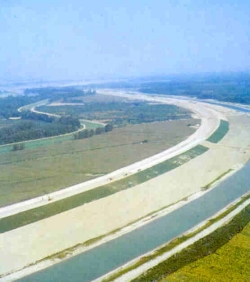
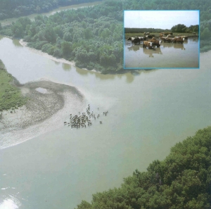
Emerging from the Vienna Basin through the Dévény Gate, the Danube enters the plains of the Kisalföld Region. The velocity of flow is attenuated, much of the sediment is deposited and the river meanders in an erratically shifting bed over the debris cone. The interwoven network of river branches accompanying the stream over a length of 30 kilometers between the Csallóköz Danube on the northern and the Moson Danube on the southern side evolved in this way. The first, basic stage of river regulation and flood control development, aimed at reducing the losses caused by the river changing her bed continually over the Kisalföld talus cone and at improving navigation, was realized between 1759 and 1914. The main channel, which has been in use ever since, was created by regulation, started in 1831 and completed in the last years of the past century. This, however, could only be maintained by dredging gravel continuously from the channel at the rate of 7 million cubic meters per year.
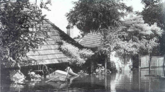
A number of benefits accrued to the region from the vast project, which has alleviated but not eliminated the difficulties. Floods through breaches in the protected and reinforced levees have devastated large parts of the Hungarian Szigetköz area in 1954, then of the Slovakian Žitný Ostrov (Csallóköz) in 1965. To appreciate the proportions of the disaster, it should be noted that in 1954 one-half of the Szigetköz area was inundated and the water rose to the secondfloor windows in the Bács district of Győr. The area flooded in 1965 was twice as large in the Žitný Ostrov area.
|
|
The rock ledge at Dömös is still a nightmare to the navigators of the Danube. Moreover, about forty fords and gravel bars over the Rajka-Gönyű stretch present obstacles to navigation, as soon as the water level in the river drops below the mean stage. For this reason, navigation over the greater part of the year is possible during the daytime hours and in a single direction only with barges carrying a reduced cargo. Even so, grounded barges awaiting cargo transfer to a rescue vessel are a common sight.
The Gabčíkovo-Nagymaros Dam Project is intended to serve several purposes:
1. Generation of 3.6 thousand million kWh of electric energy in a normal year by harnessing the hydroelectric potential of the Danube section between Bratislava and Nagymaros. Moreover, 40 per cent of the output obtained by developing the non-polluting "white fuel" will be peak power produced for five hours daily. To generate the Hungarian share of this power in other power stations, the calorific value of 650-700 thousand tonnes of oil, or 2 million tonnes of brown coal, or 11 tonnes of uranium would needed.
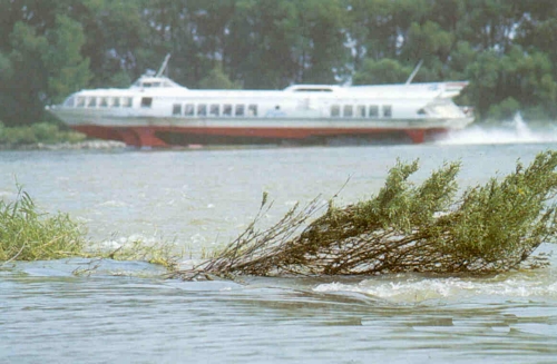
2. Creation of an international waterway with parameters that comply - even over the worst section - with the recommendations of the eightnation Danube Commission and which will meet the requirements even after the commissioning of the Danube-Main-Rhine Canal. Over the backwater reaches behind the dams the obstacles to navigation, such as narrows and sand bars will be drowned, navigation in both directions, even at night, with barges loaded to full capacity will become possible. The net time available to navigation will thus be extended by 40 per cent, the carrying capacity of the fleet will increase by 20 per cent while the fuel demand will be cut to one-half of the present. Tremendous advantages result thus from the multiple benefits of water transport, the power demand of which is lower by 30-50 per cent than that of other means of transport. The amount of gasoline or Diesel oil combustion products released into the atmosphere is accordingly smaller. The cost of vessels per ton of goods transported is also less by 60-70 per cent than of road, or rail vehicles.
3. The safety of national property in the region will be raised to a much higher level. The water masses impounded in the reservoir and in the river bed will be confined between embankments and levees capable of withstanding even the highest loads. Moreover, it will become possible to split especially high floods to the existing Danube bed and the power canal presently under construction.
4. The ancillary projects realized by the concerted use of state and local resources will provide new impetus to development in the area. Piped water supply will be provided to a number of villages. The sewer network will be expanded, roads will be upgraded, opportunities will be created for recreation and water sports attracting a larger number of tourists. Consequently, the river dam project may be regarded as the most important infrastructure development project in the region.
 |
|
The ideas at developing the power potential of the flow in the Danube date back virtually to the early times of electrification in Hungary. A Swiss company obtained a lease for developing the Bratislava-Gönyű section of the river back in 1918. The Hungarian Soviet Republic of 1919 contemplated the production of 684 thousand kWh in a normal year according to the hydropower development programme and one-third of the capacity envisaged would have been installed in the river dams upstream of the Danube Bend.
On the initiative of the Water Power Department the explorations for the dam contemplated in the Danube Bend were started in 1946. The geologic, flow pattern and geodetic surveys provided the basic data for the hydraulic model tests launched in 1952 at the Budapest University of Technology. Parallel thereto studies were started at VODOPROJEKT, Prague, Czechoslovakia, on the potential alternatives for developing the Danube stretch at Bratislava.
The coordinated studies in Hungary and Czechoslovakia were started in 1951-52. The arrangement adopted eventually took shape over a period of two decades, during which over fifty (!) alternatives have been considered. The criteria have changed with the evolution of science and technology to meet the demands which grew in complexity over the years.
In order to obtain a complete picture about the natural conditions fundamental to project formulation, the full set of data on the region furnished by the disciplines of topography, geology, hydrogeology, hydrology (covering, for instance, stages, streamflows, ice and sediment transport and navigation), biology, soil mechanics, meteorology, seismology, etc., were taken into consideration. The basic survey data were used in broad hydraulic, seepage and engineering studies performed in the laboratories of several research institutes, universities and industries.
The technical and economic criteria were established by exploring the demands and possibilities of regional and communal development, power generation, navigation, environmental protection and nature conservation, water management (including flood control, land drainage, conservation of the quality of both surface- and groundwaters, regional water supply, etc.), coordinating these individually and comprehensively.
The international status of the Danube, the recommendations of the Danube Commission together with the fact that the Danube forms over a long part of the stretch the boundary between Hungary and Czechoslovakia provided a particular background to all these activities. It was a requirement always borne in mind that the dams on this stretch of the Danube should be adjusted to the dams situated upstream and downstream: the southernmost dam in Austria and the dams contemplated at Adony and Fajsz in Hungary and the northernmost dam in Yugoslavia, so that they should form eventually an uninterrupted cascade.
A similar criterion observed consistently from the very beginning of the engineering studies was the protection of the natural environment. In analysing, and deciding on, the various alternatives during the sixties and the seventies, the professionals always adopted more stringent standards than those of the day. The need thereof was emphasized also in the agreement signed by Hungary and Czechoslovakia in 1977 and codified as a law-decree in 1978.
The studies concerned with the technical, economic, ecological, social, legal, political and aesthetic aspects of the project would fill a library. These have been discussed repeatedly, in detail and in their complexity, by the competent political, public and scientific bodies and organizations. The number of plans, studies, analyses and other documents dealing also with environmental protection is near one hundred.
The diverse questions examined included also the possibility of shifting the dam farther westward on Hungarian territory, i.e., upstream of the proposed site at Nagymaros. Alternative sites at the villages of Pilismarót and Szob were also studied, but were later abandoned for several reasons. The cost of the alternative at Pilismarót would have been higher by several thousand million forints at a lower power output, thus at higher unit costs of construction. The alternative at Szob proved unfeasible for engineering considerations and would have made the safe passage of flood flows and ice runs questionable. The rock ledge at Dömös would have remained an obstacle to navigation in both alternatives.
Repeated studies and more recent analyses taking all aspects into account have thus confirmed the correctness of the original proposal, i.e., that the eastern end of the rock bed upstream of Nagymaros and Visegrád is the optimal site for the downstream dam. The results of both engineering and economic studies have demonstrated the superiority of this site, where the structures can be adjusted aesthetically into the landscape.
The four main components of the Gabčíkovo-Nagymaros Dam Project are situated on Hungarian and Czechoslovakian territory and comprise:
|
|
|
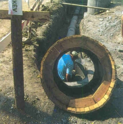
Mounting reinforcement at Dunakiliti |
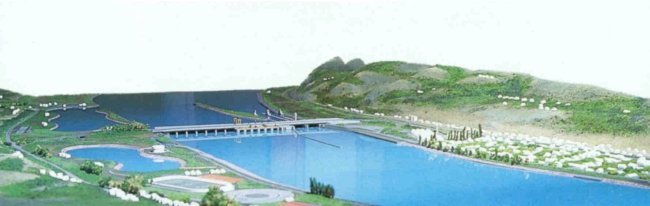
1. The Dunakiliti Weir is one of the largest structures of the project on Hungarian territory. The steel gates between reinforced concrete piers founded securely, with a wide margin of safety, arrest the runoff arriving from the Alps and create an artificial lake with a 60 square kilometers large surface area-one-tenth of Lake Balaton. The weir impounds the flood plain between Dunakiliti and Bratislava confined already by flood levees. With a volume of up to 200 million cubic meters, it will have a capacity large enough to receive and store two days flow of the Danube, thus to supply - even at times of low flow - the discharge needed to generate power in the hours of peak demand.
The Dunakiliti Weir will control the water level in the reservoir, just as the flow diverted into the power canal and released into the present Danube bed and the branches in the Szigetköz area. The auxiliary shiplock incorporated into the weir will make the original Danube bed accessible to vessels.
2. The releases from the Dunakiliti Reservoir will be split among the artificial power canal and the original bed, of which the former will receive the major share and function also as the main navigation channel.
The 17 kilometers long and 300 to 700 meters wide canal, forming the common property of the two countries, will convey the flow to the power station and navigation lock at Gabčíkovo. The height of the embankments will be 18 meters here. The water level in the canal will remain over the entire length above the terrain in order to create an as high a head as possible for power generation.
The 8 kilometres long tailrace downstream of the power station will discharge at Palkovičovo into the original river bed.
A flow varying from 50 to 200 cubic meters per second will be released into the present main channel. This flow, though substantially lower than the natural streamflow, will still be sufficiently large to serve the various interests of the population and economy in the area. Navigation for recreation purposes with shallow-draft craft will remain possible. Together with the raised water level in the lateral branches and the water compensating network in the Szigetköz area, it will maintain a blanced groundwater budget and meet the requirements of nature conservation and irrigation alike.
To illustrate the proportions involved, it should be sufficient to note that the water demands at Bratislava and Budapest are up to 4 and 15 cubic meters per second, respectively. The second largest stream of Hungary, River Tisza, carries a flow of 60 to 70 cubic meters per second at stages lower than the mean value.
The original bed between Dunakiliti and Palkovičovo will participate in conveying flood discharges and ice runs surpassing the capacity of the power canal.
Even after completion of the project the "old" Danube will thus remain a live stream and the boundary between the Hungarian Peoples' Republic and the Socialist Republic of Czechoslovakia.
3. The power plant at Gabčíkovo will comprise a power station of 720 Megawatts installed capacity and the set of shiplocks designed to allow the safe passage of river and seagoing vessels. The eight turbines of 90 Megawatt capacity each will be operated in the morning and afternoon periods with the highest power demand, the peak periods.
This mode of operation will exploit the following advantage of hydroelectric stations: they can be connected to the network within a few minutes, whereas the other types of power station - including nuclear plants take a considerably longer time to increase power generation to the desired level.
4. The terminal downstream structure of the Gabčíkovo-Nagymaros project serving the complex development of the Hungarian upstream Danube stretch is the Nagymaros Dam. Consisting of the power station, the weir and the twin navigation locks, it is intended to perform several functions:
To even out the surge waves due to the intermittent (peak load) operation of the Gabčíkovo power station.
To create over the backwater reach extending to the tailwater at Gabčíkovo the depth required for the unobstructed use of the waterway in periods when the released flow is insufficient.
To feed continuously 160 Megawatts from the six turbines into the power grid.
To help the vessels in negotiating the dam.
As a road bridge to create a permanent link between the two communities: Visegrád and Nagymaros in the beautiful landscape of the Danube Bend.
|
|
 |
|
Interception canal in the Szigetköz area |
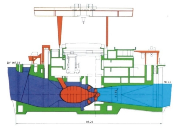
Cross section through the Nagymaros power station |
|
|
|
|
General layout of the upper Danube project |
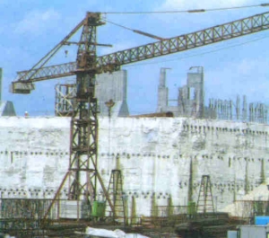
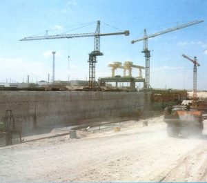
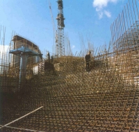
Construction under way on the Gabčíkovo power station |
|
|
|
The head created here will be substantially lower then that at Dunakiliti, exceeding by no more than 0.8 meters the highest flood level on record. The backwater curve will join the meanwater surface profile at Gönyű already. The embankments along the river will be reinforced sufficiently to withstand safely even the extraordinary flood waves or any earthquake load. Besides, in this region the probability of a major earthquake is very low, virtually zero.
The project will occupy 10 thousand hectares on Czechoslovakian and 4 thousand hectares on Hungarian territory, thus considerably less than contemplated originally. The area to be sacrificed was originally estimated at 16 thousand hectares for the Gabčíkovo power station alone, but the engineers later succeeded in constructing it on only four thousand hectares.
The Gabčíkovo-Nagymaros Dam Project will be realized jointly by the Hungarian Peoples' Republic and the Czechoslovakian Socialist Republic as an integrated and interconnected hydraulic and power generation system, forming the common property of the two states.
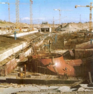
Construction of the project started in 1978 and was scheduled for completion to 1986 and 1989 in the Hungarian-Czechoslovakian intergovernmental agreement of 1977. From the outset the Czechoslovak side deployed considerable staff and equipment, whereas in the late seventies the diminishing resources available for developing its economy compelled Hungary to gradually restrict capital investment, abandon some major projects and establish priorities for those retained. Some construction jobs were therefore carried out by Czechoslovakian contractors, to be compensated for at a later date by the Hungarian side.
In the new situation several alternative solutions were considered. The consequences of abandoning the Hungarian section of the project altogether were weighed and the suspension of work for ten years was proposed. Eventually, taking into account the sums invested so far by the Czechoslovakian side as well as the Hungarian interests, the heads of the two governments agreed in 1983, following a Hungarian initiative, on delaying construction by four years and rescheduling the project accordingly.
The generating units of the project will thus be commissioned between 1990 and 1993. The first turbine of the Gabčíkovo power station will deliver current around June 1990, followed by the other seven sets at three-month intervals.
Under the revised schedule, the first unit in the Nagymaros Dam will start generating in 1992. The remaining five units will be connected to the grid at the rate of one in every second month. The power station will thus attain full capacity in 1993. Completion of construction is scheduled for 1994. Following the agreement on the revised schedule, project implementation received a new impetus and construction continued at an accelerated rate after 1985 in Hungary, too. The volume of construction performed in 1986 surpassed 3 thousand million Forints in value. A 9 kilometers long section of the Dunakiliti reservoir embankment was completed and the specially sealed construction pit of the weir was excavated 3 months ahead of schedule with Austrian co-operation.
The progress made ever since has been considered satisfactory and appears to guarantee that the ambitious project will be completed on schedule. The costs and benefits will be shared equally by the two countries.
According to the provisions of the bilateral agreement signed in 1977 and renewed in 1983, the two sides shall share equally the costs of the structures of common interest. They shall have equal proprietary rights to the main structures of the project and be entitled to one half each of the power generated by the hydroelectric stations. The main structures shall be operated jointly, regardless of the territory on which they are situated.
The Hungarian share of the project costs, estimated at the 1987 price level, amounts to 54 thousand million Forints. The major part thereof is devoted to power, the rest to river regulation and other purposes. Cost-benefit analyses have shown the cost allocated to power to be comparable with the construction and operating costs of thermal stations of similar capacity. Additional benefits include the absence of fuel costs and of emissions detrimental to the environment, moreover a service life three to four times that of thermal power stations.
The main structures (power stations, weirs, power canal, etc.) will form common property. Parallel thereto, other structures of common interest (such as bank revetments, pumping stations, etc.) will also be built and will form the property and responsibility of the state on whose territory they are located.
In addition to the structures serving common purposes, so-called national developments are also associated with the project. These serve the advancement of communities and the infrastructure, and are made possible, or more advantageous by the realization of the dam project. Similar developments will be implemented over the years following the commissioning of the dams, too, at rates depending on the actual financial situation. However, the majority thereof will be funded from other resources, although they will benefit from the outputs and improvements emanating from the principal project.
The complex development of the Hungarian-Czechoslovak Danube stretch, founded on bilateral agreements, has become a model example also of creative co-operation between two countries with different political systems. Upon the successful conclusion of preparatory negotiations in May 1986, mutually advantageous contracts were signed by Hungary and Austria in Vienna, under which Austrian contractors will participate in the construction and financing of the Hungarian components of the dam project in return for power deliveries at a later date.
The main contractor for the complete Nagymaros Dam is the Österreichische Donaukraftwerke AG-DOKW-Vienna, Austria. The company, which has already built and currently operates nine dams on the Austrian stretch of the Danube meets the requirements in all respects. Its professional staff and equipment are available to carry out the large job successfully. This is demonstrated among others also by the fact that the contractor has agreed to complete the dam and to commission the first turbine in only 33 months. The contractor has also agreed to deliver the generating units and other mechanical equipment of the dam to the site in preassembled, large units in order to cause the least possible inconvenience to the communities of Visegrád and Nagymaros.
The costs of construction and the interest on related credits will be advanced by the Österreichische Elektrizitätswirtschaft AG, with financial backing by a group of Austrian banks. Payment will be made in electric power, to be delivered between 1996 and 2015. Under this financial arrangement, the Nagymaros Dam will not appear as a separate item in the Hungarian budget. The Austrian side will in turn have access to 1,200 million kilowatt-hours of electric power yearly, which will obviate for it the need of building and operating a coal-fired power block of 200 Megawatts capacity. The job opportunities offered to the Austrian hydro-contractors and manufacturers of generating equipment, which improves the situation on the Austrian labour market, will be fringe benefits.
This, however, is only one among the aspects of the related international division of labour. The Hungarian project managers sought also other fields to locate partners with the best professional skills and the most reliable references for carrying out jobs which require special equipment and expertise. An Austrian contractor has thus been invited to excavate the construction pit for the Dunakiliti Weir and place the special sealing trough thereof. Other jobs have been awarded to Yugoslav companies after competitive bidding.
The funnel-shaped area extending from Bratislava to Nagymaros-Visegrád is to be influenced by the dam project on Hungarian territory. It sustains a population of about 500 thousand. The communities include an ancient royal residence, a present school town, frequented touristic attractions and important industrial centres.
Fertile lands, rich pastures, modern industrialized farming operations and profitable private farms set into a landscape, which has retained her natural values regardless of the changes over the decades.
The gravel layers in the several hundred meters thick alluvial fan under the Szigetköz area hold an estimated ten cubic kilometres of potable groundwater. The forests in the region are claimed to produce the richest timber yield in Hungary.
Any irresponsible human interference jeopardizing, damaging or destroying these values would constitute not simply a mistake, a blunder, but an irreparable crime against future generations.
This consideration, which prompted extraordinary care and circumspection in all stages of preparatory work, received special emphasis in the first half of the eighties, when construction proceeded at a temporarily reduced rate or was halted completely in Hungary. Following a proposal by the National Council of Environmental Protection and Nature Conservation, the consulting body to the government, the competent authorities ordered a complex environmental impact study to be compiled. The representatives of the disciplines and professions in this subject were called upon to examine the technological and ecological aspects of the project as an integrated system, taking into account all potential interactions, together with the risk factors, to synthetize in this way the various environmental, natural and social impacts of implementation. An inter-service committee was established to guide and monitor the work - pioneering even by international standards - of the scientific institutions and a large number of independent experts and scientists.
|
|
|
Representatives of the Hungarian Academy of Sciences, the National Committee of Research and Development, the Ministries of Building and Urban Development, Industry. Transport, Food and Agriculture, the National Environmental Protection and Nature Conservation Authority, the National Planning Office, the National Water Authority and the National Development Bank were all invited to this committee. The critical review of earlier conclusions just as of the more recent studies had the aim of providing answers to the following cardinal questions:
Does the project comply with the current requirements of environmental protection?
Do the various components of the project minimize effectively, or eliminate completely the undesirable impacts?
Is a modification of the plans and designs necessary or warranted?
In what ways could the various sectors make even better use of the opportunities offered by the project?
In exploring the complex interactions between the project and the environmental elements, special attention was focussed on the problems associated with water quality, water supply in the region and protection of the groundwater resources under the Szigetköz plains. The anticipated consequences of peak-load operation, groundwater control and the actual operation of the groundwater recharging-interception system, the potential ways of maintaining and improving agriculture and forestry, the biological and pedological aspects of the flood-plain forests, the possibilities of regional development were studied together with the relevant economic implications.
The complex environmental impact statement summarizing the results of some fifty former and 33 recent studies arrived at the following conclusions:
The implementation of the Gabčíkovo-Nagymaros Dam Project will not cause any irreparable damage to the environment. (In other words: appropriate design and careful operation will eliminate undesirable consequences.)
At the same time, improvements were suggested to some of the original solutions in design and construction technology.
Prompted by these results, the government again reviewed the project. In compliance with the recommendations of the impact statement, decision was taken to adopt engineering solutions that protect and improve the environment, further, to operate the project by observing strictly the requirements of optimal ecological conditions. The government commissioned further efforts for a more effective environmental protection. It also decided to continue research during construction and beyond the completion of the project.
The government also decided the installation of a complete regional observation network - referred to as the monitoring network - designed to provide accurate information on the condition of, and changes in, the environment. This network will be commissioned three years ahead of the project so as to establish a reliable basis of reference, against which any later change can be measured and assessed. At the same time, continued cooperation with the Slovakian Academy of Sciences was decided.
|
|
|
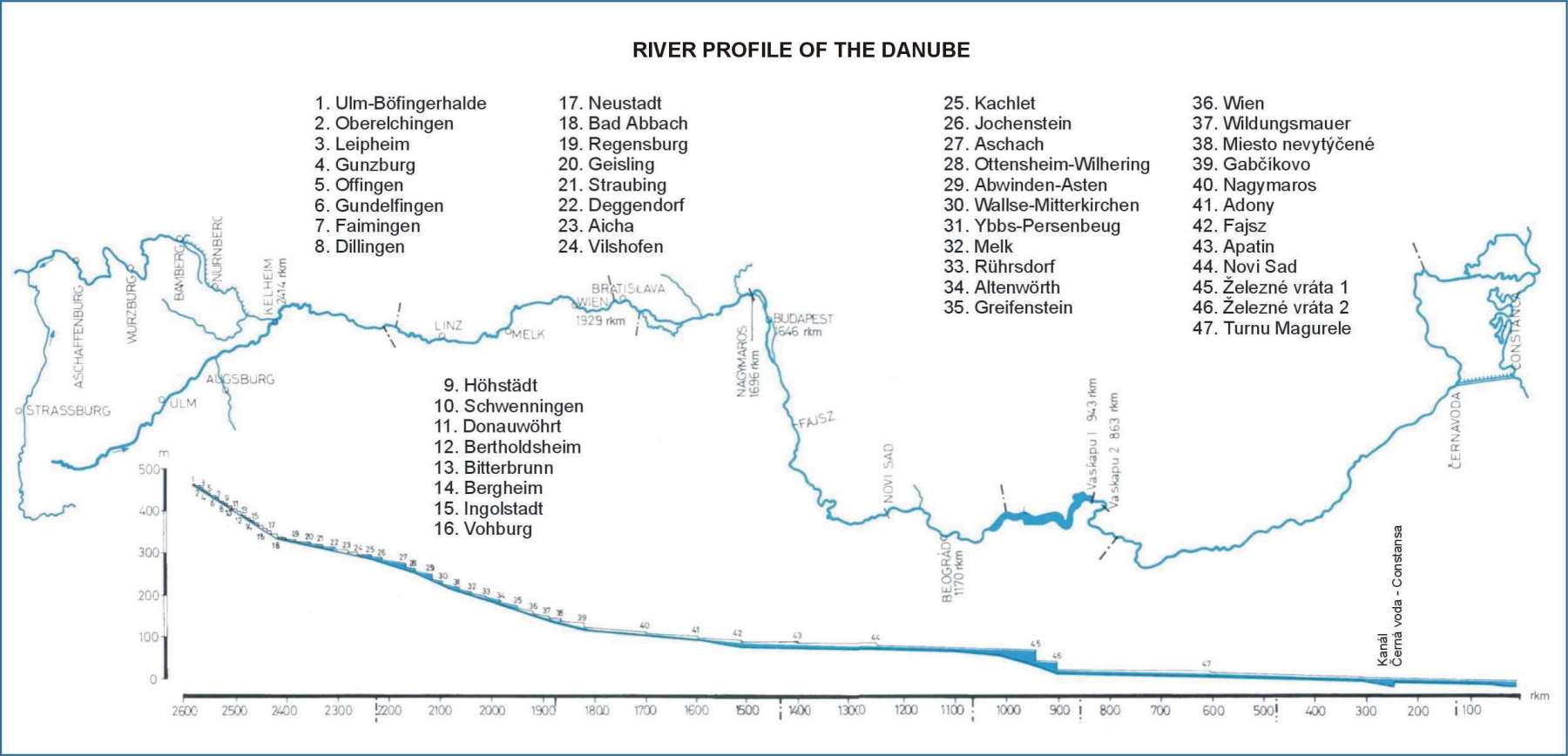
River profile of the Danube |
Besides the official statements, a number of prominent Hungarian scientists have voiced reassuring opinion on questions related to the dam project.
Mr. Bruno F. Straub, Vice-President of the Hungarian Academy of Sciences, past chairman of the National Council of Environmental Protection and Nature Conservation, which initiated the environmental impact statement, and presently acting chairman of the Communal Development and Environmental Protection Committee of Parliament, established in 1985, declared in an interview:
". . . I consider the problem from a scientific aspect, drawing on fifty years of experience in research. I have detected neither in the report, nor in the comments by third-party critics a single truly scientific objection to convince me about the inadvisability of the project.
Evidently, the construction of any river dam entails changes in the environment. Any interference is necessarily associated with changes, both adverse and beneficial. I believe the benefits from such a project should outweigh the detriments."
|
|
|
|
New structures in the Dunakiliti and Gabčíkovo areas |
|
|
|
|
|
|
|
|
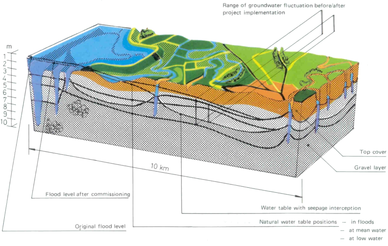
Range of groundwater fluctuation before/after project implementation |
|
Mr. György Kovács, Professor, Corresponding Member of the Hungarian Academy of Sciences, presently expert at the UN International Institute of Applied Systems Analysis, Laxenburg, Austria, wrote in a paper: "No more appropriate appraisal of the Gabčíkovo-Nagymaros Dam Project and no more pertinent summary of the debates related thereto can be found than the conclusions arrived at by the professional committees convened to study and consider the subject between 1982 and 1984. These have detected no major hazard to the environment which had not been taken into consideration in devising the protective and control measures and which would compel us to abandon the construction work started or to change the designs radically. It should be noted in addition that neither a revision of the cost-benefit analysis would warrant any major modification of the plans.
Continued research work and scientific investigations, refinements to the environmental impact statement, modifications perfecting particular features in the engineering designs and the monitoring network registering the actual changes in the environment serve the purpose of better understanding and, as far as possible, controlling the dynamics of the new environmental situation developing as a consequence of the important interferences concomitant to river canalization. This understanding is expected to permit remedial measures to be taken in time, in the early stages of any undesirable process detected, but also to make the fullest possible use of any advantages offered by the changing situation.
The present generation of Hungarian hydraulic engineers need not be ashamed before the memory of Paul Vásárhelyi and the many other prominent predecessors, when it submits, after careful deliberations, to the general public a solution to the problems of modern life."
Mr. Imre Petrasovits, Doctor of Agricultural Sciences, Professor at the Gödöllő University of Agriculture, wrote the following comments on the impacts of the project on the agricultural environment:
The anticipated natural and social impacts and significance of complex development along the Hungarian Danube stretch is reminiscent of the vast river regulation, reclamation, flood control and land drainage projects started and largely completed in the past century. Reclamation, flood control and drainage in the Great Plains in the nineteenth century created the opportunities for the capitalist development of agriculture in Hungary, but also for its present successes.
". . . no detriment has been identified to agriculture, or to the environment which would occur as a consequence of project implementation. In the upstream part of the Szigetköz area, the arable lands will increase in size after the commissioning of the Dunakiliti Weir, mainly because of the interception of the present underseepage waters. No reduction of the agriculturally productive area is anticipated in the MiddleSzigetköz. The elimination of rising groundwaters by the control system will even permit a changeover to more intensive farming methods on round 1000 hectares. In the downstream Szigetköz area the water table is expected to rise, but the harmful consequences thereof can be avoided by operating properly the interception-drainage network envisaged.
In the Komárom, Esztergom and Pilismarót area, further, in the valley of the Ipoly river an estimated 2000 hectares were thus far excluded from any more intensive agricultural production owing to the annually recurring floods. The control measures will provide complete safety to production in the future. The higher level of flood safety and the resulting increase in the value of agricultural lands may be listed among the benefits in the Szigetköz area as well. Forestry experts concur in the opinion that the risk of any change in the stands and productivity of the flood-plain forests in the Szigetköz area is virtually nil, except for a narrow riparian belt. Here new species may have to be planted, which adjust better to the new moisture conditions.
The hydrobiological conditions of fish life are expected to improve along the backwater reach above the Nagymaros Dam. Over the Szigetköz stretch, on the other hand, considerable changes in the species composition and in the aquatic biotope should be anticipated. Intensive research is under way to predict the quality and extent of these changes.
Parallel to the implementation of the Gabčíkovo-Nagymaros Dam Project, the waters in the Szigetköz area will be regulated into an integrated system and a new network of groundwater control (recharging and intercepting) canals will be constructed. The 6 to 9 meters wide range of water table fluctuations caused by stage variations in the Danube will thus be eliminated. The water cycle in the area will be accelerated, water supply to the belt between the "Old" Danube and the Moson Danube will be improved and by computerized control the groundwater level will be raised and lowered as and when required by the interests of agriculture or the natural environment. As an interesting fringe benefit, stagnation frequently observable in the abandoned branches will be eliminated, the recharging-infiltration canals forming a network of live watersurface in the landscape.
|
|
|
|
|
Range of groundwater fluctuation before/after project implementation |
||
|
|
||
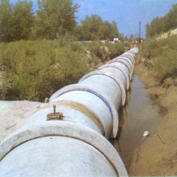
In Hungary and Czechoslovakia alike, great efforts are devoted to reducing the volume of untreated wastewaters. The treatment plant relying on Japanese technology has already been commissioned for the oil refinery at Bratislava and construction work is under way on the municipal sewage treatment plant of 400 thousand cubic meters per day capacity. In the ecological programme adopted recently the construction of altogether 95 sewage treatment plant is envisaged. As a result, the sewage load in the Czechoslovak catchment of the Danube will reduce to one-tenth of the present value within the next ten years.
On Hungarian territory sewerage will be provided to 43 communities and industrial plants in the project area by 1995. Regional networks of water distribution and sewerage are envisaged at Visegrád and Nagymaros. Moreover, under a system combining state subsidies and local resources sewage and wastewater treatment will be provided at the major riparian towns, viz. Győr, Komárom, Esztergom, Tatabánya and Oroszlány. The sewer networks will be expanded and piped watersupply will be introduced in all villages in the Szigetköz area. Recent hydrogeological and hydraulic analyses have repeatedly confirmed that the dam project will cause higher recharge rates to the gravel aquifers under the Szigetköz area, adding not only more, but better water to this important source of supply. The sediment depositing over the backwater reach presents no pollution hazard. The water in the Dunakiliti reservoir will be exchanged in three to four day cycles, one of such cycles taking two years to complete in Lake Balaton. A fraction only of the suspended sediment is thus liable of settling out in the 60 million square metres large reservoir and of causing a potential annual silting rate of millimeter order. Over the Dunakiliti-Nagymaros stretch on the other hand, the higher flow velocities at times of flood releases will prevent any extensive silting.
The quality of the discharge passing the dams will be influenced beneficially by the operation of the turbines in the power stations at Gabčíkovo and Nagymaros. The violent agitation and rotating movement imparted to the water by the large wheels of turbines are conducive to higher rates of oxygenation, rising thus the assimilation capacity and reducing the length of time needed degrade the various pollutants. Noting also in this context that the quality of Danube water classified presently as of Category II (slightly polluted) has improved already in 1986 along the Szigetköz area and downstream of Gönyű alike, we feel justified in expecting favourable results from subsequent efforts.
Nor are the sources of supply downstream of Nagymaros endangered. The character of the river remains unchanged over this section of the Danube, the biological parameters of the water and the flow conditions following the present pattern. The recharge to, and the yield from, the bank-filtered wells sunk on Szentendre- and Csepel Islands, as well as the quality of the drinking water at Budapest are controlled by factors unrelated to the dam project.
The Gabčíkovo-Nagymaros Dam Project will change the face of a 150 kilometers long riparian strip on the Hungarian side between Rajka and Nagymaros. The range influenced is, however, a considerably wider one, so that the living conditions and welfare of hundreds of thousands of people are involved.
The benefits of the project and the fullest possible exploitation thereof have been explored in a comprehensive programme of regional development, the fundamental aim of which was to formulate a policy aimed at improving the situation of the people in the region.
The programme outlined by the concerted efforts of experts from the relevant disciplines and professions, perfected subsequently in a series of open, public debates has reviewed the possibilities of improving the infrastructure and summarized the actions required.
|
|
 |
|
|
|
||
 |
 |
No Hungarian village or town will be inundated as a consequence of the project. Relative to the proportions of the project, the number of real estates expropriated - against equitable damages - will be negligibly small. Most of these houses are in areas inundated more or less frequently and would be submerged by the backwater created. The basic principle observed in land clearing is and will remain to demolish houses only where absolutely essential. The economy of the region will undergo no major changes on account of the dam project. The trades and professions indigenous to the region will thus have ample opportunities for flourishing and expanding. The projects of land clearing and regional development will be realized as national investment drawing on three sources for funding. For attaining certain objectives, state subsidies will be relied upon, whereas others will be realized with the financial resources of the local agencies of administration and the population. The ambitious programme was formulated expecting the attraction which the controlled waters, regulated banks and larger watersurfaces will exercise on those seeking recreation, tourism and water sports.
The Dunakiliti Reservoir offers ideal conditions for the organization of both domestic and international rowing and sailing events, while the willows and glades growing on the shores may become camping centres. The Danube branches at Koppánymonostor and Tát, further, the severed lakes at Pilismarót and Dömös - the latter in combination with the already popular thermal water bath at Lepence - may also prove attractive to many for touring, camping, rowing and sailing.
Parallel to the construction of the Dam Project, programmes will be implemented for developing the thermal water resources in the Szigetköz area. A sanatorium is contemplated in the western corner of the area, at Hédervár. Additional thermal baths can be built at Lipót, Mosonmagyaróvár and Győr. Recreation centres are contemplated in the vicinity of Győrújfalu and Győrzámoly. The expansion of village tourism is envisaged at Ásványráró, Dunasziget, Sokorópátka, further, along the Moson-Danube and Kimle, Dunaszeg and Dunaszentpál. A site for an international camping has been located at Likóc-puszta.
Considerable attention has been devoted to improving transport. A new international river port will be built at Győr. The southern motorway bypassing the town has also been included in the plans. The east-west road network in the area will be modernized and new roads will provide access to the growing recreation centres.
The need of expanding the network of shops, restaurants and other services of the catering trade parallel to the anticipated growth of tourism has also been recognized. The buildings erected to accommodate the work force on the project were thus designed to serve - in a form restored and reconditioned - as tourist or normal hotels after the completion of construction.
Special care has been devoted to preserving the aesthetical values and natural features, further, to developing the communities of the Danube Bend, which attracts many tourists already and is capable of accommodating 200 thousand visitors in summer. Anticipating a further expansion of the tourist trade, new excursion centres have been envisaged in the Visegrád-Nagymaros and Esztergom-Vaskapu areas. The existing small garden and shack lots, which deteriorate the landscape, will be changed into a more pleasing type of land use and work will be started on modernizing infrastructure.
A nationwide public competition has been announced, inviting architectural designs for the Nagymaros Dam and the ancillary structures, but only some of the proposals were considered acceptable by the evaluation committee. Contracts have thus been placed for new designs incorporating the best solutions submitted.
The architects were required to cornply with stringent requirements. For acceptance, any design had to conserve the unique landscape of the Danube Bend and to avoid industrial structures.
The specifications for the dam comprising the weir, the powerhouse, the twin navigation locks and the road bridge on the crest linking Visegrád and Nagymaros required an unbroken trace, a horizontally articulated structure to fit in all respects harmonically into the landscape. The use of dark, or glaring colours was also declared undesirable. Lighting was to be solved by means of concealed fixtures with appropriate arrangements for floodlighting. Separate lanes were also required for vehicular and pedestrian traffic. The power generated had to be conveyed by underground cables out of the core of the region, viz. as far as the Szob plains on the left-hand bank and the Malom Creek at Dömös on the right-hand bank.
The best design submitted and adopted as a starting basis in preparing the final drawings proposes horizontal patterns to relieve the monotony of large concrete surfaces. Mixes of different shade and the use of vegetation on certain parts served to merge solid surfaces unobtrusively into the surroundings. A partly recessed solution has been adopted for the operation building and the other ancillary structures on the banks to make them less conspicuous.
Another public design competition preceded, and established the criteria for, the development plans and designs of the community center of Nagymaros. The team responsible for synthetizing the ideas presented in the award-winning designs received proposals of high professional standards concerning virtually all the criteria. The renewal of this community in a setting between the hills and the Danube will therefore preserve its particular atmosphere and make it more attractive.
PUBLIC INVOLVEMENT |
|
Communication between the professionals preparing the decisions related to
the Gabčíkovo-Nagymaros Dam Project, on the one hand, and the people living
and owning property in the area influenced by the development, on the other
hand, has taken a wide variety of forms.
The public hearings at which the plans, their justification, objectives were presented and the potential benefits outlined started in the seventies and have continued to these days, growing in both attendance and depth of discussion.
The character of information flow always depended on the events and requirements of the particular period. At the first public hearings the professionals outlined the general aspects and features of the project. In the early eighties, in the months of uncertainty concerning the new deadlines and during the preparation of the environmental impact statement, the purpose of the debates was to review and screen impartially the various options and to confront diverging opinions. Then the debates intensified on the level of state agencies and scientific workshops. As demonstrated by the wealth of information gathered in recent years, these were fully successful also in this respect. On the other hand, in the subsequent stage of preparing the detailed designs, the discussions at the local public bodies focussed on the works and structures affecting directly the particular communities and on the consequences thereof.
Public involvement in, and control over, the project was further intensified by the establishment in 1985 of the Communal Development and Environmental Protection Committee of Parliament, to which the project managers were obliged to report regularly and which monitored progress on, and the environmental impacts of, the project continuously.
The growing public interest and activity is reflected also by the fact that whereas the number of public discussions on the dam project remained less than sixty during the five years between 1976 and 1981, the debates extending into the late night hours at the meetings of the local political and public bodies took place on thirty occasions in 1986 alone. The aim of the planners at these meetings was to find the optimal solutions with the co-operation and approval of the people affected in the region. The approach adopted was motivated by the realization that any ambitious landscape shaping project can only be implemented successfully with the consensus, approval and active participation of the people living in the project area.
Any comment made, opinion voiced or proposal submitted at these hearings has received careful consideration and scrutiny, and was incorporated into the plans, or rejected depending on its merits and drawbacks. A number of such proposals and initiatives have led to modifications in the original plans.
At Esztergom, for example, the original trace of the embankments has been changed as suggested by representatives of the population, reducing the area to be inundated from eighty hectares originally envisaged to no more than twelve and excluding thus from the reservoir a strip of the flood plains which includes the entire Primás Island, a popular recreation spot of the town offering leisure time activity to up to ten thousand people.
At Nagymaros the debates prompted the engineers to change the trace originally contemplated for relocating the Highway No. 12 and the curvature of the road leading to the dam. The number of houses earmarked for demolition has been reduced. At Zebegény some of the properties will be returned to the original owners after filling the riparian zone.
Over the bank section along Szob and at Ipolynádasd the original engineering designs have been changed into more complicated ones in order to save several houses. An open competition has been announced for the recreation area developed in the area of Pilismarót. The alternative plans have been presented at a public exhibition, offering even the possibility of a public vote on them. The principle adhered to has been to continue the debates to the very last stage of planning and design with the aim of finding an optimal compromise between the requirements of the project and the local demands and interests.
This exchange of ideas does not replace, evidently, but supplements the nationwide flow of information on the project. Reports were regularly published in the press and broadcast on radio and television on the progress of construction. Also, these media have assumed an important role in representing the interests of the population living in the area of the project.
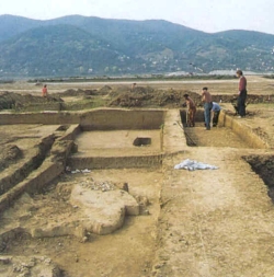
Measuresaimed at exploring and preserving the treasures and major archeological monuments of ancient cultures in the project area were taken already in the earliest stages of the project preparations. Under the guidance and with the active co-operation of staff members of the Hungarian National Museum, archeological surveying of the Danube stretch involved started in 1959. Since it was soon realized that no important relics could be expected in the Szigetköz area, the surveys were concentrated on the region between Komárom and Nagymaros.
The explorations revealed that the slightly over 100 sites which will eventually become inundated, represent the history of the area from the Neolithic Age to medieval times, but differ widely in value.
A settlement in the Pilismarót-Szob area, from the Copper Age, a Neolithic one at Basaharc, Avar and Celtic graves at Pilismarót and near the Malom Creek a minor Roman fortress have been unearthed. The latter was one of the most valuable monuments. The remains of a medieval convent have been discovered on Primás Island at Esztergom.
Most of these relics have been transferred to the museums of Visegrád and Esztergom, but some are on display in the permanent archeological collection of the National Museum.
Excavations are currently under way in the areas Visegrád-Lepence and NeszmélyNyergesújfalu. The former site is expected to yield monuments ranging from prehistoric to medieval times, whereas prehistoric relics are anticipated from the latter. Archeological work will be concluded at all sites before starting impoundment.
The absence of ancient relics is offset by the wealth of scenic and natural assets offered to the visitors of the Szigetköz area. Prompted by this recognition, work has been launched on the compilation of a live inventory with scientific thoroughness on this region of particular views and atmosphere before the flow regime in the present Danube is changed.
Commissioned by the National Council of Environmental Protection and Nature Conservation, a survey has been started to survey the components of the present flora and fauna, the habitats and frequency of occurrence of protected animal and plant species. In this way the knowledge available on the islands will be enriched, while laying the groundwork for studies over subsequent decades. The present will thus serve as an exact reference basis for the future.
Care has also been taken at conserving the traditional scenic beauty of the region. Planning on the dam project and the early stages of implementation thereof resulted in declaring almost ten thousand hectares as the Szigetköz Nature Conservation District in 1986, thus providing protection to, and ensuring the preservation of, the scenic, botanic and zoological assets of the area.
The conservation district consists of two major parts, the first extending in the Danube flood plains from Dunakiliti to the Medve road bridge, the second forming a string of wet groves along the Moson Danube.
Vestiges of the former hardwood grove forests, white alder stands, subrelic waterbeach and oak forests, further, the precious grey poplars, which may play an important role as gene banks in the future, still thrive in this region. Alder marshes and wet meadow bogs indicate ancient severed meanders. The undergrowth is dotted with Siberian iris, hamerocallis, sword bifoliates, a wide variety of ochris, . . .
The wonderful islands of the entwined Danube branches at Ásványráró, which shelter and feed a wide variety of waterfowl form part of the nature conservation district. The grove at Bordács with a mixed stand of tall ash, black oak, gray and black poplar, is reminiscent of the ancient Szigetköz scenery, the old landscape, of which little has been preserved to these days and which will continue changing inevitably regardless whether the dam project is implemented or not.
|
|
||
 |
||
 |
The overwhelming part - round 96 per cent - of the streamflow in the Hungarian rivers originates beyond the national boundaries and introduces an ever growing pollution load to the country. The flood waves rushing down the high mountains in the neighbouring countries overtake each other in the Hungarian Plains giving often rise to violent floods.
Wet years with ample flow are normally followed by dry ones bringing severe draught, the effects of which cannot be alleviated unless the water storage capacity is increased.
Careful management of all water resources available to the nation, including streamflow- and pollution control will thus remain imperative over longer terms.
The Gabčíkovo-Nagymaros Dam Project has already reached implementation stage. To the general public it represents the immediate future, but the professionals responsible for managing the water resources of the nation think in terms of longer perspectives. They have identified two further potential dam sites over the Hungarian stretch of the Danube, one at Adony, the other at Fajsz, to complete the long-term development plan of the river. Moreover, studies have been started in Yugoslavia with the aim of selecting the most suitable site for the Dam at Újvidék (Novi Sad) and of preparing construction. The common driving force behind this exploration of future potentials is the recognition that the rational and circumspect development of the resources which nature has endowed upon us will continue to play an essential role in the steady and balanced progress of mankind.
|
|
|